
| 
|
May 11, 2003 Boston Sunday Globe (page B2)
Starts & Stops
Mac Daniel
Car-free in Boston
It's been years since one of the most important transportation
resources in Boston has been updated, but finally it's here.
No, It's not a road, a rail line, or a bridge. It's a book called
"Car-Free in Boston," and it's an indispensible
guide to getting around Boston without a car (or bike).
The guide has been around since 1977 but hadn't been updated since
1995. The problem largely was money. The publishers, the
Association for Public Transportation, ran out of
funds. Thankfully, in stepped the folks at Rubel BikeMaps,
and the 10th edition was born.
The updated editions should be in stores May 21. To learn more or
mail-order a copy, contact Rubel BikeMaps, P.O. Box 401035, Cambridge,
MA 02140 or visit http://www.bikemaps.com.
© Copyright 2003 Globe Newspaper Company.
|
 (Text of article at right.)
|
|
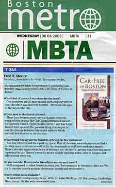
June 4, 2003 Boston Metro (page 11)
T Q&A
Fred R. Moore
President, Association for Public Transportation Inc.
The Association for Public Transportation, in partnership with Rubel
BikeMaps recently published the 10th edition of "Car-Free in Boston."
Q: What kind of research was done for the book?
A: Our members are all mass-transit users and they give us tips. The
MBTA was also very helpful-they basically gave us the keys to the city.
Q: What's new in this latest edition?
A: They have been so many service changes since the ninth edition
(1995): the Old Colony commuter rail service has been revived, Night
Owl bus service and Bus Rapid Transit have opened. The greatest thing
that we put in was the synergy between bikers and walkers. We do
exclude how to drive to the stations.
Q: What would you say are the benefits of being car-free
in Boston?
A: You don't have to look for a parking space. Most of the time, even
when you can find a parking space, you have to walk so far that you
might as well have used mass transit. There's also the aggravation factor
of driving a car: the traffic, getting lost, shoveling snow, repairing the car.
I haven't owned a motor vehicle since the 1980s. I live in Saugus, and I
bike to work every day.
Q: So you consider Boston to be friendly to mass-transit users?
A: Well, compared to other American cities, yes. But compared to
European cities, no. We try to emulate American ideas about mass transit
and we shouldn't.
Q: Where is the book available?
A: At bookstores and specialty shops. Write to: Rubel BikeMaps, P.O.
Box 401035, Cambridge, Mass., 02140. On the web at www.rubel.com.
© Copyright 2003 Boston Metro.
|
June 16, 2003 The Patriot Ledger (pages 16-17)

scanned version of article (about 250K bytes)
Without wheels: 'Car-Free' is a valuable transit guide
By JODY FEINBERG
Once you've read the book ''Car-Free in Boston,'' there's no reason to
stay housebound because of a lack of wheels or away from the city
because of distaste for traffic. In fact, you can get just about anywhere in
Greater Boston and beyond without a car once you know how to take
advantage of the myriad trains, buses and ferries.
''A lot of people don't realize all the options there are,'' said Quincy
resident Madeleine Noland, a managing editor and cartographer for the
book. ''Public transportation can be easier and more convenient than they
thought.''
If you're skeptical, check out ''Car-Free in Boston: A Guide for Locals
and Visitors,'' by the Association for Public Transportation (Rubel
BikeMaps, Cambridge, $9.95). The book returns in a revised 10th edition
after being out of print since its last update in 1995.
''During the hiatus, a lot of demand built up for this book because people
were used to getting a new edition every few years,'' Noland said, who
takes the MBTA Red Line into the city.
Since 1977, the Association for Public Transportation, a nonprofit
advocacy group, has published the book. This is the first edition published
by Rubel BikeMaps.
Updated, the book describes every Boston-are transit route by subway,
bus, train and boat, including schedules and fares. Or, you can choose
from hundreds of destinations - towns, parks, beaches, museums, cultural
attractions - and find out how to get there by public transit. It's so well
organized, with a 10 page index, that you quickly can find what you're
looking for.
''Car-Free in Boston'' also is a travel guide, providing highlights of the
best that Greater Boston and beyond has to offer.
''It's an idea generator for people who aren't sure what they want to do,
whether they've lived here a long time or are new to the area,'' Noland
said. ''You can look up Quincy and see there are these cool things here.
It's home to Wollaston Beach, Blue Hills Reservation and a president's
birthplace. And I didn't know (before working on the book) that New
Bedford is a jewel and it's surprisingly easy to get there. From South
Station, a bus goes right into the heart of the historic district.''
To plan a trip, you can search by town or city or by attractions such as
museums, theaters, malls and universities. Under each community, there's
a ''recommended excursion'' with details on how to get there. In some
instances, however, you'll need flexibility and patience because trips are
infrequent.
Beyond the MBTA trains, buses, commuter rail and ferries, the book
includes regional transit authorities, Amtrak, private bus lines, commuter
boats, ferries, airports, as well as guided tours. If you're traveling with a
bike or use a wheelchair, everything you need to know is there. The maps
are especially useful for downtown Boston, Providence, Worcester, New
Bedford and other communities.
And the book has useful fare information, including the added fares at
Quincy Adams and Braintree stations, senior citizen rates and the family
discount on commuter rail lines. What's more, how many people will be
surprised to learn that the MBTA guarantees timely service and will
refund fare if the train or bus is delayed more than half an hour?
For her part, Noland takes the MBTA Red Line from North Quincy to
Davis Square in Somerville on work days and takes the MBTA into
Haymarket for outings with her husband. She avoids the hassle of driving
and expense of parking, and she likes to walk to and from the station and
read on the subway.
''To me, it's a total win,'' she said. ''I wish that the upkeep were a little
better, especially in key stations, but Boston's system is very, very good.''
Barry Steinberg, another Quincy resident, also uses trains and buses to get
around Quincy and into Boston.
''I'm a transit enthusiast,'' said Steinberg, who is clerk of the Association
for Public Transportation. ''When you drive, you don't talk to people or
see people. You miss a little bit of culture that people in past generations
had.''
Jody Feinberg can be reached at jfeinberg@ledger.com.
© Copyright 2003 The Patriot Ledger.
June 22, 2003 The Boston Sunday Globe
(City Weekly section page 9)

scanned version of article (about 230K bytes)
The 10th trip was the toughest, but 'Car-Free' arrives
by Mac Daniel, Globe Staff
Andy Rubel, a software engineer turned "Rubel BikeMaps" maker,
was pedaling around Boston Common recently carrying several
copies of the latest edition of "Car-Free in Boston," a local how-to-
get-around-sans-automobile classic, when he decided to drop into
the Common's visitors' center and hand off a fresh copy.
The book is billed as a guide for locals and visitors and focuses in
easy-to-understand, non-Internet terms of getting around Boston and
the surrounding region in anything other than a car.
It's a book that's been around Boston in various guises since 1977,
and was long published by the nonprofit Association for Public
Transportation, which had come to depend on the attention and
revenues generated by the book's quasi-biannual publication to help
fund many of the advocacy group's projects.
But when Rubel walked into the visitors' center, it had been six years
since the last edition of the book was published, and he wasn't sure
what to expect when he pulled out this 10th edition and handed it to
the workers behind the counter.
"Hey, here, it's a present," Rubel recalled saying as the eyes of the
woman behind the desk lit up.
"Oh, we know that book," she said, pulling out what Rubel later
described as a book so worn and ragged that it was no longer square-
-an old and much-loved 9th edition.
"It was oval," Rubel recalled. "The corners were worn off, and the
right-hand side slants off where the pages had been thumbed over
the years. I have never seen a more used book."
Out of empathy or sheer joy, Rubel gave them two copies.
If more people knew about it, "Car-Free in Boston" could well hit
the local bestseller's list, a strange thing for a homegrown book that
simply tells you how to get around without a car, both on the MBTA
and off.
What makes it so popular, however, is its simplicity. If the Children's
Museum is your destination, look it up in the "Destination" section
and the book tells you how to get there. Want to know which buses
stop at which subway lines? The "Route Details" section has it.
"The T's website can't do that," said Madeleine Nolan[d] of Rubel
Publications.
The genesis of the 10th edition, however, is proof that the book fills
a vital need in Boston.
In 1995, while preparing for the 10th edition, there was a problem at
APT with funding, according to current APT president Fred Moore.
The Big Dig was hurting the agency's advocacy, interest was waning
in the movement, and funds were tight. Worst of all, a vicious cycle
had been created. Money made by "Car-Free in Boston" helped to
pay for "Car-Free in Boston." But because the publication had been
delayed, Nolan[d] said, "we don't have the money to fund Car-Free in
Boston because we don't have Car-Free in Boston.... The cycle got
broken. [APT] were in a little bit of a pickle with this."
APT board members were asked to take out second mortgages on
their homes to fund the book's publication. And by 1998, the 10th
edition was more or less done when the funds all but dried up to
print it. There the book languished. "The patient would have bled to
death before we could stop the bleeding," said Moore.
Still, people would call APT's voice mail and scream: "When's the
new Car-Free coming out?"
Finally, a member of the APT grew frustrated enough to try to get
the book published. This time, however, the old computer files had
gone completely missing.
It then became Rosemary Jason's job to scan each page of text from
a handful of 10th edition printouts and reassemble the work. It was
painstaking, Nolan[d] said, because the scanning process can't tell the
difference between some letters and numbers, such as Os and zeros.
So Jason approached Rubel. APT "want it, want it, want it, and they
just didn't have the know-how or the tools to get it done," recalled
Nolan[d].
And with that, the 10th edition was finally updated--with some
necessary bicycle components--and fully born.
Rubel worked with the board and came up with a contract "that
worked for everybody," Nolan[d] said. Rubel will now do the updates,
and the APT gets some of the sales proceeds, though less than
before, which frees the organization to "get the time freedom to get
all the things that they want to do without having to worry about
Car-Free again."
"People are really pleased to have this back," said Nolan[d].
Before the 10th edition was published in May, Wordsworth's in
Harvard Square back-ordered 25 copies. After the book's first
weekend on sale, the shop ordered 100 more. The Globe Corner
Bookstore has ordered twice already, having sold a case (62 books)
since May.
"It's a clearinghouse for information," Nolan[d] said. The book "was
conceived and written by transit nerds...but I don't think you can get
this information anyplace else."
Rubel said "Car-Free in Boston" fits into his small company's goals.
"I have the goal of improving our transportation infrastructure by
making it less monolithic and less dependent on cars, and this was
just another piece of the puzzle," he said.
"Now," said the APT's Moore, "even if the organization goes down
the chute, 'Car-Free' will go on."
The book costs $9.95 plus shipping and handling and is available
through www.bikemaps.com/cfbos.htm.
© Copyright 2003 Globe Newspaper Company.
July 2003 TRANSreport
(Transportation News from the Boston Metropolitan Planning Organization, page 3)

scanned version of article (about 80K bytes)
Car-Free in Boston, 10th edition -- This new edition, which was
produced by the Association for Public Transportation in partnership
with Rubel BikeMaps, includes information about MBTA service additions
since 1995 [previous edition of Car-Free], such as
Night Owl service, the Silver Line, and the Old Colony Commuter Rail Line
Restoration. It is available in bookstores and specialty shops and may
also be requested by writing to Rubel BikeMaps at P.O. Box 401035,
Cambridge, MA, 02140, or logging on to their Web site at www.rubel.com.
Summer 2003 Commonwealth Magazine
(pages 34-35)

scanned version of article (about 200K bytes)
Car-Free guide is back on track
By Robert David Sullivan
After nearly a decade in the shop, Car-Free in Boston is back in
service--and, for those who prefer their transportation public
rather than private, not a moment too soon.
A compendium of every conceivable way of getting around
Greater Boston without getting behind a steering wheel, Car-Free
has had loyal fans since 1977, when it was first published by the
nonprofit Association for Public Transportation. But some MBTA
riders have been worrying that their copies would fall apart before
they could get replacements.
After being updated every two years or so, the guide disappeared
from bookstores after 1995, when the costs of production became
too much for the APT to handle. This year, the group handed
publishing duties over to Rubel BikeMaps, a Cambridge-based
firm well known in New England's cycling community.
The new edition, which sells for $10, looks a bit sleeker than its
predecessors, with more-detailed maps (including pick-up spots
for rent-by-the-hour Zipcars) and bus schedules.
"Our standard is one of being informative without being
ridiculously punctilious," says editor Jeff Perk, who notes that the
MBTA "has its idiosyncracies that have grown over the years." So
while Car-Free tries to explain the convoluted fare system of the
Green Line, it won't tell you to watch out for the outdated signs,
which in some stations go back to the Carter administration.
"THE SILVER LINE. . .MADE FOR AN EDITORIAL HEADACHE."
While Perk and his staff avoided judgmental language in listing
the services of the MBTA and other transportation providers, they
had to tread carefully in describing one new feature on the mass-
transit landscape. "The Silver Line defied every categorization,"
Perk says. "That made for an editorial headache."
Car-Free ultimately swallowed the MBTA's party line, describing
the Silver Line as "bus rapid transit" and placing its schedule with
those of the subway lines rather than the bus routes. The Silver
Line, which began operation late last year, currently consists of
natural-gas-powered buses running in a "dedicated" lane along
Washington Street from downtown to Dudley Square; the T
ultimately plans to extend the route through tunnels to the Seaport
district and Logan Airport.
But the "bus rapid transit" label rankles Fred Moore, president of
the APT, who calls it "the most flagrant misuse of terminology
since 'German Democratic Republic,'" referring to the communist
regime in the former East Germany; he says the Silver Line is
nothing more than a bus. (Moore often peppers his rhetoric with
such politically charged language; the "systemic extermination of
light rail," in which he includes the MBTA ripping up the tracks
of the old Green Line branch to Watertown, he refers to as the
"trollocaust.")
The APT was founded in the mid-1960s to fight proposed
superhighways through and around Boston--one of which would
have traveled the path of the current Orange Line--and the group's
membership has fluctuated in sync with various transportation
controversies in Boston, according to Moore. (He says that
advocates of a rail link between North and South stations "bailed"
from APT after their pet project lost steam.) Moore won't say how
many members his group has today, though he calls it "lean and
mean." He'd be glad to get some new blood, though, and Moore
sees Car-Free as a good recruiting tool.
And despite his occasional reference to "bike path hyenas" who
want to tear up unused railroad tracks, Moore sees strategic
advantage in the publishing partnership between APT and Rubel
BikeMaps founder Andy Rubel. "Andy is going to be the bridge
builder between the bike lobby and the transit lobby," says Moore.
Perk agrees, to a point. "Everyone involved with the [Car-Free]
project would characterize themselves as rabidly pro-rapid
transit," Perk says, but he adds that the book won't be used as a
platform for more specific political views. "You'll find no snide
comments about the expansion of the Greenbush [commuter-rail]
line, for example."
Though their styles of advocacy may differ, Moore and Perk both
see Boston as a great place to be car-less. "All the carping about
the T's ability to govern itself and provide adequate services
aside," Perk says, "by and large Boston is very well served by
mass transit."
Copyright © 2003 The Massachusetts Institute for a New Commonwealth
Last update: 2003 July 24